Drone Services for Commercial Property Developers: Boost ROI
You’re managing a massive commercial development. You have deadlines, budgets, and a dozen stakeholders breathing down your neck. The old ways of tracking progress feel slow and clunky because they are.
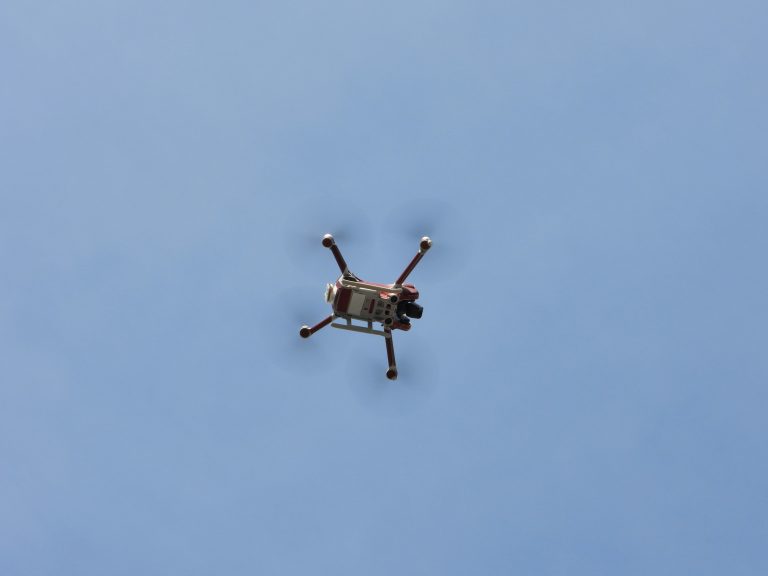
What if you could see everything, from every angle, without ever leaving the office? This is where professional drone services for commercial property developers change the game entirely. They give you eyes in the sky and data you’ve only dreamed of.
Using drone services for commercial property developers is not about getting a few cool photos. It is about making smarter, faster, and safer decisions from start to finish on your commercial real estate projects.
Why Drones Are a Total Game-Changer
You probably think of drones as toys or for cool video shots. But for commercial projects, they are serious workhorses. They save you time and money, and honestly, they reduce a lot of headaches.
First, think about safety. Construction sites can be dangerous places. A drone inspection of a roof or building facade is much safer than sending a person up on a ladder or scaffold.
This dramatically cuts down the risk of accidents on your site, which is something every project manager wants. The Bureau of Labor Statistics consistently shows that falls are a leading cause of death in construction, a risk that drones help lower.
Then there is the money aspect. A traditional land survey can take weeks and cost a fortune. An aerial drone can map hundreds of acres in a single day for a fraction of the cost.
You get highly accurate and valuable data much faster, which helps your project stay on schedule and under budget. The efficiency gained from utilizing drones allows resources to be allocated to other critical areas of real estate development.
The Core Drone Services for Commercial Property Developers You Should Know
So what can a drone actually do for your project?
The real value is in the specialized drone services that help at every single stage of construction development.
Site Selection and Land Surveying
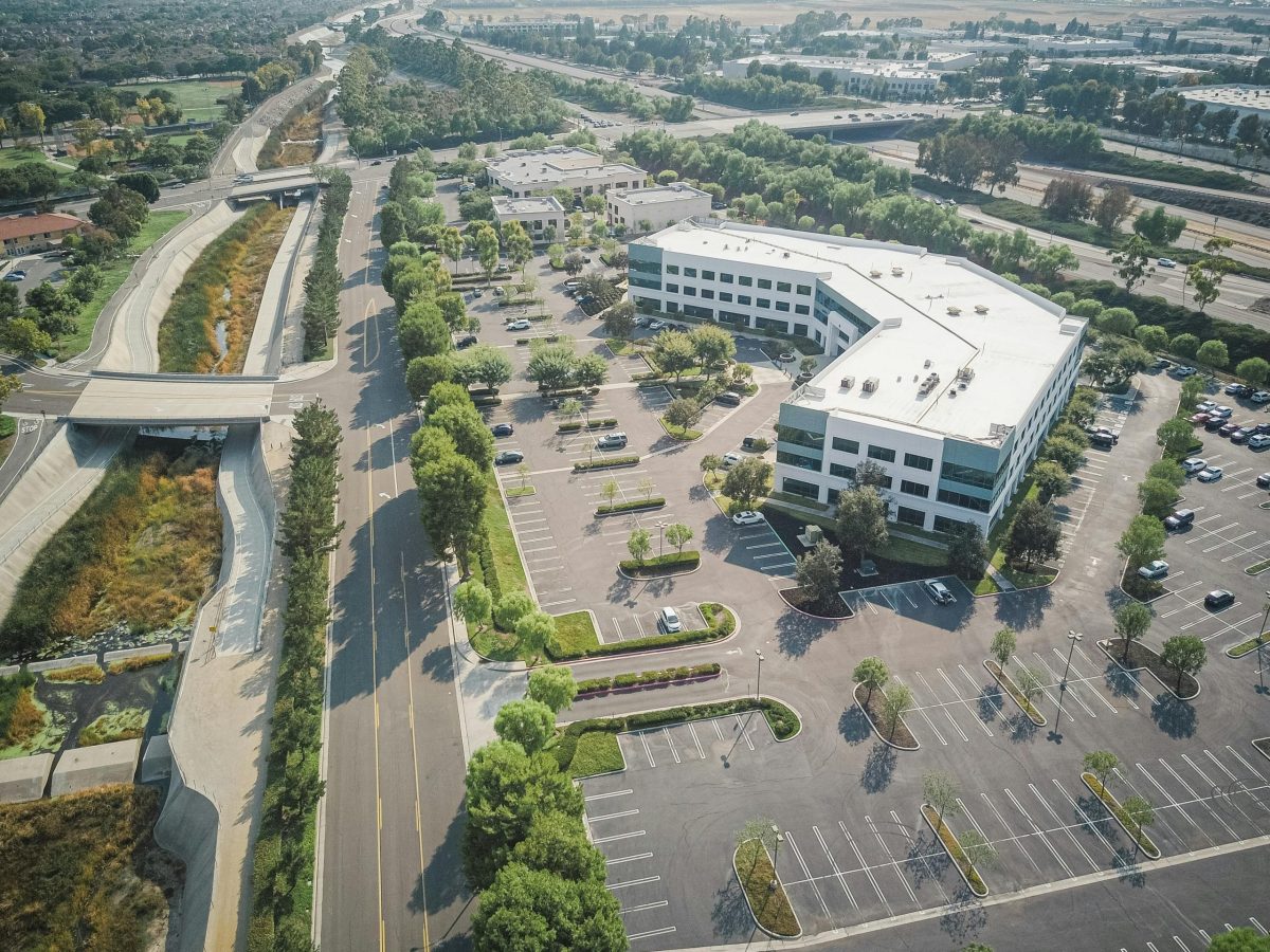
Before you even break ground, an aerial drone can give you an incredible advantage. Flying over a potential site can give you high-resolution aerial imagery. You can see things you would absolutely miss from the ground level.
Is there unrecorded water runoff? Is the terrain more challenging than it looks? A drone service helps you answer these questions early during site selection, preventing costly surprises later.
They are also amazing tools for topographical mapping. A drone equipped with LiDAR or photogrammetry sensors can create detailed 3D maps of the land. This gives your architects and engineers precise information to work with, a foundational step in any estate development project.
Construction Progress Monitoring
This is probably the most popular use of drones in construction today. Imagine getting a complete visual update of your entire construction site every single week. A drone can fly the same programmed route repeatedly.
This gives you a consistent “then and now” look at how things are moving along. This monitoring construction progress method is far superior to sporadic ground-level photos. It provides a holistic view of the project management timeline.
Are the earthworks on schedule? Have the foundation footings been poured correctly? You can check these things from your computer, comparing real-time aerial footage to your plans.
You can then share this drone video with investors and clients to show them everything is on track. It builds confidence and keeps everyone in the loop without needing constant site visits. This level of transparency can be crucial for stakeholder relations.
Asset and Building Inspections

Once your building is up, the work is not over. You need to inspect it, and regular inspections drones can handle are efficient and thorough. This is especially true for large commercial property like warehouses, office buildings, or retail centers.
Drones make site inspections so much easier and safer. A commercial drone can fly close to the building to capture ultra-high-resolution images of the roof, facade, windows, and utility installations. These high-resolution images are critical for detailed analysis.
You can spot small problems before they become huge, expensive ones. Think about finding a small roof leak or cracked facade early. A quick drone aerial inspection can save you from massive repair bills and is a key part of modern property management.
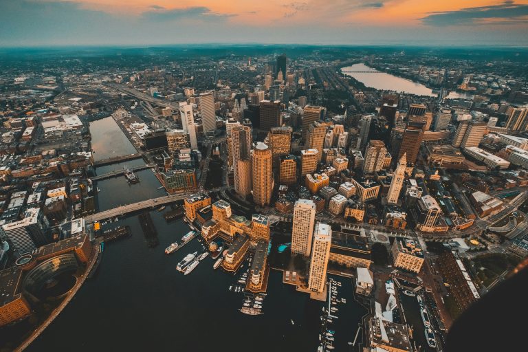
Marketing and Real Estate Imagery
After your project is complete, you need to lease or sell it. Nothing shows off a commercial real estate property like stunning aerial photos and videos. Drones capture beautiful imagery that ground-based estate photography just cannot.
A dramatic aerial shot showing the building, parking, and its prime location can make a huge difference in your estate marketing materials. This kind of real estate photography aerial view gives context that is impossible to get from the street, leading to faster sales.
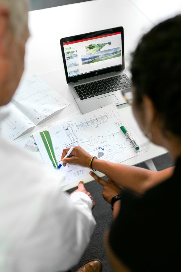
From Data to Decisions: What Do You Actually Get?
A drone service is more than just flying a machine around. The real magic happens when you process the data it collects. You get powerful tools that help you make very informed decisions about your real estate property.
Creating 2D Orthomosaic Maps
This sounds technical, but it is pretty simple. A drone takes hundreds or even thousands of photos of your site from directly above. Special software then stitches these photos together to create a single, high-resolution, map-like image that is geographically accurate.
You can zoom in and see incredible, highly detailed views of the entire property. This is a leap forward in how you can manage properties and job sites. It allows for a level of oversight previously unimaginable.
This map lets you take precise measurements of distances, areas, and even stockpiles of materials like gravel or sand. It is an essential tool for planning and management. You can overlay site plans on the map to check if everything is being built in the right place.
Building 3D Models
Photogrammetry software takes the drone imagery a step further. It can turn those 2D pictures into a fully interactive 3D model of your construction site or completed building. You can rotate it, zoom in, and look at the project from any angle.
This is incredibly helpful for visualizing the final product and for communicating progress to people without a technical background. It also helps in calculating volumes and seeing how your project interacts with the surrounding environment. Stakeholders love seeing a 3D model instead of just looking at flat blueprints.
These models can also be integrated with BIM (Building Information Modeling) software. This allows for clash detection, where potential conflicts between structural, mechanical, and electrical systems are identified before they become costly rework on the construction site. It’s a proactive way to use the data drones provide.
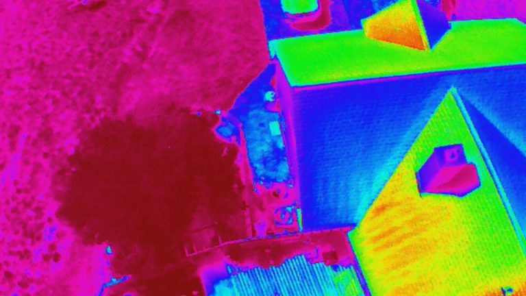
Thermal Imaging for Inspections
Some drones can be equipped with a high-resolution camera that also sees heat. These thermal cameras are an amazing tool for inspecting commercial buildings. You can spot areas of heat loss in the winter or see where cool air is escaping in the summer.
It helps identify issues with insulation or seals around windows and doors. This aerial imaging can lead to significant energy savings over the life of the building. The ability to collect valuable data on energy efficiency is a huge plus for property owners.
Thermal drones are also fantastic for roof inspections. They can detect moisture trapped beneath the roof’s surface, which is often a sign of a slow leak that is invisible to the naked eye. Finding these issues early saves you from water damage and expensive structural repairs.
How to Hire the Right Drone Service Provider
Not all drone pilots are created equal. You are trusting them with an important part of your project. So, you need to make sure you hire a professional, experienced company that offers the right videography services and photography real estate solutions.
Here is what to look for:
- FAA Part 107 Certification: Any person flying a drone for commercial purposes in the United States must have a Remote Pilot Certificate from the FAA. Ask to see it to confirm they operate legally and safely.
- Proper Insurance: A professional drone company will carry significant liability insurance. This protects you, your real estate property, and their equipment in case of an accident. Ask for a certificate of insurance before they start any work.
- A Strong Portfolio: Look at their past work. Have they worked on commercial real estate drone photography projects similar to yours? You want a provider who understands the specific needs of commercial real estate development.
- Knowledge of Data Processing: The best providers do not just fly the drone. They know how to turn the raw data into useful reports, maps, and marketing videos that you can actually use to make decisions. Ask them about their software and the deliverables you can expect.
- Industry Experience: A provider familiar with the construction and commercial real estate sectors will understand your goals better. They can offer insights and suggestions that a generalist might miss. They will speak your language, from site plans to final leasing.
Hiring the right team makes all the difference. You are not just buying photos or aerial videos. You are investing in data and insights that can seriously benefit your project.
Conclusion
In the end, it is all about working smarter, not harder. You have to juggle so many moving parts in commercial development. Adopting new technology can feel like just one more thing on your plate, but this is different.
Using drone services for commercial property developers gives you an edge. They deliver better data, improve safety, and save you significant time and money on your commercial real estate project.