Drone Orthomosaic Mapping for Solar Projects: A Game Changer
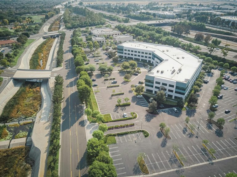
Getting a commercial solar project started means putting a lot of pieces together. You believe you have the perfect project site in Massachusetts, but an inaccurate survey throws your entire layout into chaos.
Old-school surveying methods often lead to expensive surprises and costly rework down the road. Picture this: you get a digital twin of your property, almost flawless. You’d see it all before you ever lift a shovel. Imagine how much easier solar construction gets! This technology helps companies in Maine, New Hampshire, and the wider New England area build solar farms smarter.
Good drone data turns your hunches into hard facts. Getting a full, bird’s-eye look at the whole property becomes easy with drone scans. You’ll make smart choices right when a solar setup begins.
An overview of the subjects:
- So, what’s drone orthomosaic mapping, really?
- The Traditional Way vs. The Drone Way for Solar Site Surveys
- How Drone Orthomosaic Mapping for Solar Projects Actually Works
- Top Benefits for Your Next Solar Project in New England
- Beyond Planning: Other Drone Applications in the Solar Lifecycle
- Conclusion
What Exactly Is Drone Orthomosaic Mapping?
Let’s clarify what an orthomosaic map truly is. It’s not just a single, pretty picture taken from the sky. It is a highly detailed and geographically accurate map built by stitching together hundreds or thousands of individual drone images.
A single photo from a plane or satellite contains distortions, especially around the edges where buildings may appear to lean. Orthomosaic mapping software corrects these distortions. The software adjusts for terrain elevation changes to produce a map that is both high-resolution and allows for precise measurements.
The Traditional Way vs. The Drone Way for Solar Site Surveys
For years, site surveying was strictly a boots-on-the-ground job. A team would spend days, sometimes weeks, walking a site with GPS rovers and total stations. This was the only way to get the topographical data needed for initial ground plans.
While traditional ground-based surveying methods work, they are slow, expensive, and introduce safety risks for the survey crew. Surveyors must cross difficult terrain, face inclement weather, and might miss subtle ground features that aerial mapping would spot easily. The data, while accurate at specific points, requires extensive interpolation to guess what is happening between those points.
Drones change this whole equation. A map drone can fly over a huge site in hours, capturing all the needed drone data. It’s not just faster; the information is far more comprehensive, providing real-time data and a complete picture of the site.
You no longer have to guess what the terrain looks like between survey points. Instead, you have a clear picture of the entire property. The major benefits include enhanced safety, reduced costs, and a much faster turnaround for actionable information.
How Drone Orthomosaic Mapping for Solar Projects Actually Works
You might think this process sounds complicated, but it’s actually quite streamlined. It breaks down into a few clear steps, moving from the field to the computer and finally into your project plans. This systematic approach delivers consistent and reliable results for site construction.
Step 1: Flight Planning and Data Capture
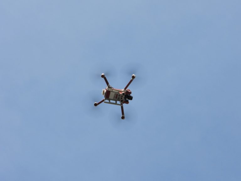
Everything starts with a well-designed flight plan. Using specialized software, licensed drone pilots map out an automated flight grid over the project area. This grid tells the drone exactly where to fly to capture images with sufficient overlap, which is typically around 70-80%.
For even greater accuracy, surveyors may place Ground Control Points (GCPs) on the project site. These are physical markers with known, precise GPS coordinates. The drone mapping software later uses these points as anchors to lock the map into an exact real-world position, increasing its global accuracy significantly.
Then, the drone flies the mission autonomously. It can capture hundreds or thousands of high-resolution images, each tagged with its own GPS data. The entire data collection process for a 100-acre construction site might only take a few hours, helping you save time.
Step 2: Image Processing with Photogrammetry

Once the drone images are collected, they are uploaded into photogrammetry software. This is where the process to generate orthomosaic maps truly begins. The software analyzes the overlapping photos and identifies thousands of common tie points between them.
Using these tie points, it builds a 3D point cloud of the entire site. From this point cloud, it generates several vital outputs for solar design. As Autodesk notes, photogrammetry creates detailed 3D models from photographs, which are foundational for modern planning.
The main product is the orthomosaic map, but you also get a Digital Surface Model (DSM) and a Digital Terrain Model (DTM). The DSM shows the elevation of everything on the site, including trees and buildings, while the DTM shows just the bare ground. These models are the foundation for all subsequent analysis and design work.
Step 3: Analysis and Implementation
With these detailed models in hand, project managers and engineers can get to work. The data can be exported into standard industry software like AutoCAD or GIS platforms. Here, they can perform critical tasks for solar design and site planning.
Engineers can precisely map out solar panel layouts, access roads, and trenching paths for cabling. They can calculate cut-and-fill volumes to level parts of the site, helping to manage earthwork costs effectively. Most importantly, they can perform analyses that just were not possible before with this level of accuracy.
Top Benefits for Your Next Solar Project in New England
Why should you adopt this for your next commercial solar project in Massachusetts or Maine? The benefits go far beyond just a cool map. It directly impacts your budget, timeline, and the long-term performance of the solar farm.
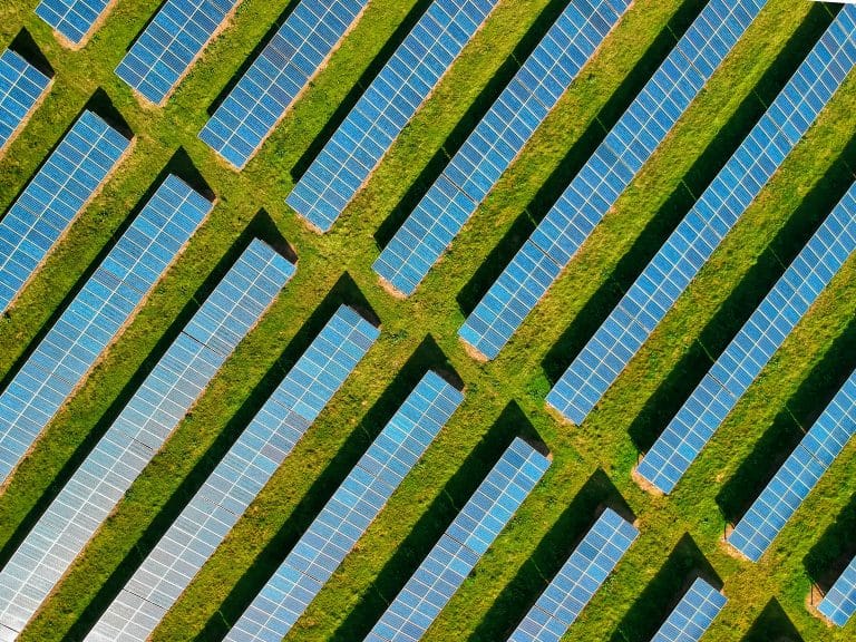
- Enhanced Accuracy in Site Planning . You can virtually lay out every single solar panel, rack, and inverter with confidence. This precision minimizes material waste and avoids the costly discovery during construction that your plans do not fit the actual site conditions.
- Detailed Topographical Data . The DTM gives you a true picture of the land’s surface. You can plan for stormwater management, grade the site efficiently, and position infrastructure correctly based on the real-world slopes of the land.
- Precise Shading Analysis . Using the DSM, you can model how shadows from trees, nearby buildings, or other parts of the solar array itself will fall across the site throughout the day and year. For rooftop solar installations, this helps identify roof obstructions like vents or HVAC units that could impact panel placement.
- Better Energy Production Forecasts . Good shading analysis leads to more accurate energy production forecasts, which is critical for the financial viability of any solar project. As studies on PV system performance show, poor shading analysis can severely impact a project’s output.
- Faster Project Timelines . Compressing the site survey timeline from weeks to a day or two has a massive ripple effect. You can move into the design and approval phases much faster, shortening the entire project lifecycle. This gets your project generating power and revenue sooner.
- Improved Safety and Reduced Risk . Sending a drone up is much safer than having a survey crew cross treacherous ground or work near potential hazards. You remove a significant amount of risk from the initial phase of the project, which can help with insurance and liability concerns.
- Comprehensive Project Monitoring . The first map acts as a baseline. You can fly the site again during construction to track progress, verify that completed work is matching the design, and easily communicate updates to stakeholders with clear visual proof. This level of site documentation is invaluable for record keeping.
Beyond Planning: Other Drone Applications in the Solar Lifecycle
The value of using drones does not stop once construction begins. They are a powerful tool throughout the entire life of a solar farm. A great orthomosaic map is just the beginning for a seasoned drone expert.
Construction Monitoring

During the build-out, periodic aerial surveys can create updated orthomosaic maps. Project managers can overlay these new maps on top of the original design plans. This allows them to quickly spot any deviations and verify work is on schedule.
It is an effective way to verify that piles are installed in the right locations or that trenching for electrical conduits follows the plan. Drones provide detailed progress reports, helping to catch mistakes early before they become expensive problems to fix. This continuous monitoring construction progress makes communication with contractors clearer and more accountable.
This process of providing real-time data ensures that all stakeholders are aligned. The ability to quickly identify potential issues on construction sites is one of the biggest advantages. It transforms project management from reactive to proactive.
As-Built Documentation
After construction is finished, one final drone flight can produce a perfect as-built survey. This final map is an exact digital record of the completed work. It is incredibly valuable for the operations and maintenance (O&M) teams who will manage the site for the next 20-30 years.
This as-built site documentation gives them a precise reference for the location of every component. If a specific solar panel or junction box needs service, they know exactly where to go without wasting time searching. This documentation is also vital for handovers, asset management, and even for future real estate transactions involving the property.
Operations and Maintenance (O&M)
Here, the type of drone technology used often expands to include thermal imaging. A drone equipped with a thermal camera can fly over the entire solar farm and quickly identify panels that are hotter than the ones around them. These “hot spots” can indicate a range of problems, like cracked cells, failed bypass diodes, or soiling.
Some advanced aerial surveys may even use a multispectral camera. This technology can assess vegetation health around a ground-mount solar installation. It helps O&M teams manage overgrowth that could cause shading or become a fire hazard, thereby protecting the asset and improving its drone life efficiency.
Finding these faults manually on a large site can be like looking for a needle in a haystack. A thermal drone inspection can scan thousands of solar panels in a single flight. This proactive approach to maintenance helps keep the plant operating at peak efficiency and maximizes energy output over its lifetime.
Conclusion
It’s clear that drone mapping has moved far beyond being a niche technology. For developers and construction companies working on solar installations, it is becoming an essential part of the modern toolkit. The technology provides a level of detail and accuracy that legacy surveying methods just cannot match.
By investing in a proper survey at the beginning, you set the entire project up for success. You reduce risk, control your budget more effectively, and build a more efficient, productive asset. Using drone orthomosaic mapping for solar projects is one of the smartest decisions you can make to get ahead in a competitive industry.