Drone Orthomosaic Mapping in Maine: An Aerial Perspective
You’re looking at a huge plot of land in Augusta or a sprawling construction site in Portland.
Don’t miss a thing.
Every last particular matters.
Imagine getting a top-down view of everything, all parts neatly connected into one huge, super clear picture.
You’ll see everything with drone orthomosaic mapping.
You’ll finish your projects sooner, keep more money in your pocket, and face fewer surprises with this system by your side.
Understanding drone orthomosaic mapping in Maine is the first step toward transforming your operations.
What Exactly Is an Orthomosaic Map?
Let’s break down the term.
Think of it like a giant, super-accurate photo puzzle created from the sky.
A drone flies a pre-planned grid pattern over your property or job site, snapping hundreds or thousands of photos with precise geographic data.
Software then takes these overlapping photos, corrects for distortions from camera tilt and terrain, and stitches them together.
The final result is a single, geometrically corrected image called an orthomosaic.
This process of creating maps from photos is known as photogrammetry.
Every single pixel on the map is in its correct real-world location, a process called georeferencing.
You can take precise measurements of distance, area, and volume directly from the map.
Why Drones Are a Game-Changer for Mapping
For years, getting this kind of detailed aerial data was expensive and slow.
You had to hire a plane or helicopter, a process that took weeks to arrange and came with a high price tag.
The final images often lacked the detail you really needed for close analysis.
Drones have completely turned this on its head. They are faster, cheaper, and safer for collecting site data.
You can have a professional drone services team map a 50-acre site in just a couple of hours and have the data processed within a day or two.
The data you get is also much better.
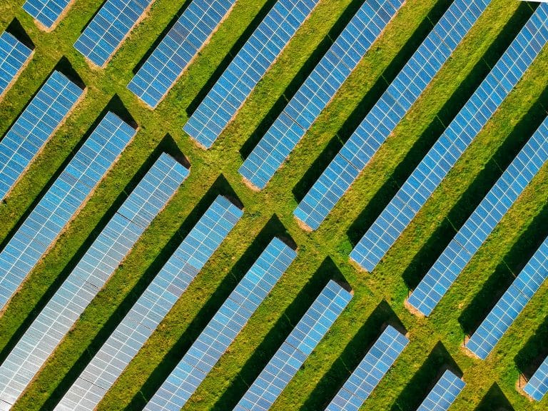
Drones fly lower than manned aircraft, so the images they capture have incredible resolution, often down to less than an inch per pixel.
This level of detail, combined with the potential for survey-grade accuracy, was just not practical with older methods.
Beyond safety from not needing manned aircraft, drones can also access difficult or hazardous locations.
Inspecting unstable slopes, dense forestry, or active work zones can be done without putting personnel at risk.
The Process of Drone Orthomosaic Mapping in Maine
So, how does it all come together?
Getting a high-quality orthomosaic map involves a few key steps.
It’s a mix of careful planning, expert flying, and powerful software.
Step 1: Planning the Mission
Everything starts on the ground with detailed mission planning.
Before a drone even takes off, the flight is mapped out using specialized software.
The flight path, altitude, image overlap, and camera settings are all defined to meet the project’s goals.
This step also includes checking for any flight restrictions.
The Federal Aviation Administration (FAA) has strict rules for commercial drone operations, detailed under its Part 107 regulations.
A professional drone company will handle all this, including checks for proximity to airports like Portland (PWM) or Bangor (BGR) and applying for any necessary airspace authorizations.
Weather is another major factor, especially in New England.
Flights must be conducted in clear conditions with low winds for the best results.
A good provider will monitor forecasts and schedule the flight for an optimal window.
Step 2: Flying the Site
Once the plan is set, the licensed FAA-certified drone pilot arrives on-site.
For projects requiring the highest level of absolute accuracy, the pilot may set up Ground Control Points (GCPs).
These are marked targets on the ground with precise GPS coordinates measured by a surveyor.
Some advanced drones are equipped with RTK (Real-Time Kinematic) or PPK (Post-Processed Kinematic) technology.
These systems provide survey-grade accuracy without needing as many GCPs, saving time in the field.
The drone then flies the automated grid pattern, capturing images with at least 70-80% overlap to create a robust dataset.
Step 3: Processing the Data

After the flight, the real work begins.
The hundreds or thousands of geotagged photos are uploaded into advanced photogrammetry software like Pix4D or Agisoft Metashape.
This software analyzes the images and their location data, identifying millions of common tie points in the overlapping photos.
Using complex algorithms, the software builds a 3D model of the site.
From this 3D model, the 2D orthomosaic map is generated.
The process can take several hours or even a few days, depending on the size of the project and the required level of detail.
How Businesses Can Use This Technology
The real value of orthomosaic maps is in how you use them.
This is a practical tool that helps businesses across Maine make smarter decisions.
It provides a reliable visual record and measurable data for a variety of applications.
Construction Project Management
For construction companies, these maps are a critical tool for effective construction site monitoring.
You can track progress week by week with incredible clarity against plans and BIM models.
Are the excavations on schedule?
Has the foundational work started?
You can also use the map for precise volumetric analysis.
Need to know how much gravel, soil, or sand is in that stockpile?
The software can calculate it with impressive accuracy, helping you manage inventory and costs without guesswork.
This technology also improves communication, keeping everyone from project managers to investors on the same page with objective, visual updates.
It is also used to create as-built surveys, verifying that the final construction matches the design specifications.
Land Surveying & Engineering
Drone mapping is a powerful supplement to traditional methods for land surveyors and civil engineers.
It provides a fast way to generate detailed topographic surveys.
These surveys are essential for site planning, grading design, and drainage analysis.
For large land development projects, a drone can capture existing conditions across many acres in a single day.
This data provides the foundation for initial design and feasibility studies.
The complete GIS data integration means the drone-captured models can be used directly in AutoCAD, Civil 3D, and other engineering software.
Commercial Real Estate Insights

If you work in commercial real estate, seeing is believing.
An up-to-date orthomosaic map is a powerful marketing tool for Maine aerial photography.
It shows potential buyers or tenants the entire property and its surroundings in stunning detail.
It’s also great for site selection and due diligence.
You can analyze a plot of land for development potential from your desk.
Measure setbacks, check for drainage issues, and plan site layouts, all before ever breaking ground.
Infrastructure and Utilities Inspection
Maintaining infrastructure like roads, bridges, and power lines is a massive job.
Drones make asset management and inspections safer and more efficient.
Instead of sending a crew to walk miles of pipeline, a drone can cover the same area in a fraction of the time.
The high-resolution orthomosaic can reveal minor problems before they become big ones.
A small crack in a road, an overgrown tree near a power line, or early signs of erosion are easy to spot from the detailed map.
This proactive approach can prevent costly repairs and service disruptions.
Agriculture and Environmental Monitoring
Maine’s agricultural and natural resource sectors can also benefit.
Farmers can use orthomosaic maps combined with multispectral cameras to assess crop health.
Differences in plant color on the map can indicate stress from a lack of water or pests, allowing for targeted treatment.
Environmental agencies can monitor wetlands, track erosion along the coastline, or manage forests.
The ability to compare maps created at different times shows how a landscape is changing.
Research published by organizations like the American Society for Photogrammetry and Remote Sensing often highlights these valuable applications.
The Data Deliverables: What You Receive
An orthomosaic map is just one piece of the puzzle.
The same drone data can be used to create several other valuable products.
A professional drone mapping service will typically provide a package of data to support your needs.
| Data Product | Description | Primary Use |
| Orthomosaic Map | A high-resolution, distortion-free 2D map. | Visual reference, taking 2D measurements (distance/area), and progress tracking. |
| Digital Surface Model (DSM) | A 3D model that includes the tops of buildings, trees, and other features. | Line-of-sight analysis, 3D visualization, and calculating heights of objects. |
| Digital Terrain Model (DTM) | A 3D model of the bare earth, with all buildings and vegetation stripped away. | Understanding topography, planning earthworks, and calculating cut/fill volumes. |
| 3D Point Cloud | A massive set of data points, each with X, Y, and Z coordinates. | The raw data for building other models is used directly in CAD and GIS software. |
| 3D Mesh Model | A textured 3D model that looks like a realistic digital version of the site. | Visualizations, marketing materials, and virtual site tours. |
| Contour Lines | Traditional topographic lines showing changes in elevation at set intervals. | Site planning, grading plans, and hydrologic analysis. |
This data can be exported in formats compatible with the software your teams already use.
This includes programs like AutoCAD, ArcGIS, and other engineering or design software.
This easy GIS data integration is what makes the information so powerful and immediately useful.
Choosing the Right Drone Mapping Provider
Getting accurate and reliable results requires skill and professionalism.
When you’re looking for a partner for drone orthomosaic mapping in Maine, here are a few things to consider.
Licensing and Insurance
First, make certain any pilot you hire is an FAA Part 107-certified drone pilot. This is the law for any commercial drone operation.
Ask to see their certificate and check their credentials.
Also, ask about insurance.
A professional operator will carry significant liability insurance that covers any potential accidents.
This protects your business, your property, and your employees.
Experience and Equipment
Ask about their experience with projects similar to yours.
A company that has worked on many construction sites will understand your specific needs better.
Look at their portfolio, case studies, and past work to judge their capabilities.
The right equipment also matters. Professional-grade drones and high-resolution cameras are a must.
They should also be using sophisticated software to plan flights and process data for the best results.
Understanding of Data
A good provider does more than just fly a drone.
They understand the data they are collecting.
They should be able to help you understand how to use the maps and models they provide to achieve your business goals and ensure the data meets your accuracy requirements.
Conclusion
The landscape of project management is changing, and technology once out of reach is now a practical tool.
Drone mapping gives you a perspective on your projects that was impossible to get just a few years ago.
It’s a faster, more affordable, and safer way to gather critical site data.
The applications for drone orthomosaic mapping in Maine continue to grow.