Boost Your Project: Aerial Mapping Services Boston Explained
Imagine yourself right on the border of a sprawling new project, ready to reshape a piece of the Boston region.
That perfect plan on paper?
Bringing it to life almost always means running into unexpected problems.
You’ve got to clearly see the land’s shape, property lines, and all existing buildings and plants.
Conventional land surveys prove slow and expensive, frequently omitting critical site details.
This is where getting a good look from above really pays off.
Ever wonder why Boston’s construction project managers are all about aerial mapping before they start building? We’ll show you exactly why they love it and how you can get those same advantages.
What you’ll discover.
- Aerial mapping. What’s that, anyway?
- Why Your Project Needs More Than a Satellite View
- The Core Technologies Driving Aerial Mapping Services Boston
- How Different Industries Benefit from Aerial Mapping
- Conclusion
Why Your Project Needs More Than a Satellite View
You might wonder if you can just use a free tool like Google Maps. For a quick overview, it might suffice, but for any professional project in Massachusetts, New Hampshire, or even Rhode Island, you require precision that free tools cannot provide. Satellite imagery is frequently months or years out of date and has a low resolution, preventing you from seeing critical details.
Imagine calculating soil volumes for earthworks based on an old, blurry image; the risk of error is significant, and these mistakes lead to budget overruns and project delays. Forgetting a single detail, like a missed deadline or an overlooked clause, can quickly turn into thousands of dollars of surprise expenses. While traditional methods involving ground surveys are accurate, they are extremely time-consuming and can place land surveyors in potentially hazardous conditions on a busy construction site.
Mapping from above fills a major need. You get incredibly precise measurements delivered in days, not weeks. This allows you to make informed decisions based on the current state of your site, not its condition six months ago. Since the data is digital, you can easily share it with your entire team, ensuring architects, engineers, and investors are all working with the same up-to-date information.
The Core Technologies Driving Aerial Mapping Services Boston
The impressive capabilities of these services stem from several key pieces of technology working in harmony. Understanding them reveals the true power of what is offered by a professional mapping service.
Photogrammetry: Turning Photos into Data
Aerial photogrammetry is the foundational technique for most aerial mapping projects. Imagine measuring anything you see in a picture. We grab thousands of crisp pictures from above, looking at the area from all sides. After that, smart software finds the common points to construct a detailed 3D map.
The result is a highly detailed and visually rich 3D point cloud or mesh. This digital twin of your property is fully interactive, allowing you to measure building heights, calculate stockpile volumes, and check construction progress against design plans. People use this to share information, confirm work quality, and build a full site history.
LiDAR: Mapping with Light
For projects requiring the highest level of precision, especially concerning the ground surface, LiDAR is the answer. LiDAR, which means Light Detection and Ranging, shoots out laser beams to collect information about an area. A drone LiDAR sensor mounted on a UAV emits thousands of laser pulses every second, which bounce off surfaces and return to the sensor.
This process generates an incredibly dense and accurate point cloud of your site. LiDAR stands out because it penetrates vegetation. Its laser pulses, using specific wavelengths, exploit minute spaces in thick tree cover to accurately depict the terrain beneath. This matters for making a “bare earth” model. It gives us the exact ground shape, a discovery NOAA specialists presented.
You can use this to plan new towns, understand water flow, and chart where all the utilities go. The accuracy of drone surveying with LiDAR is so high that it is frequently used for engineering-grade designs and topographic surveys.
Real-World Applications

Aerial mapping really shows its power. Lots of different industries use it every day. This drone technology is not a one-size-fits-all solution. This tool easily adjusts, ready to tackle the exact issues that only your company might face.
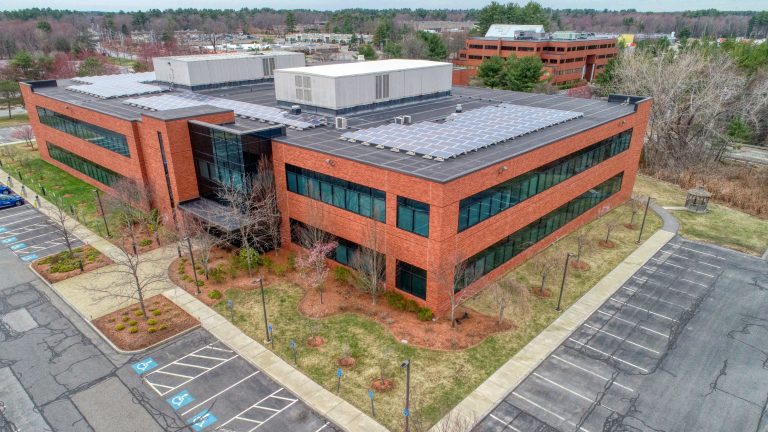
For Construction and Site Development
On a construction site, timely information is paramount. Aerial photography and mapping frequently shows you your entire property, letting you easily keep an eye on all construction progress. This lets you monitor construction progress with exceptional clarity by overlaying design plans on the current orthomosaic map to spot deviations instantly.
A primary use case is for earthworks calculations, where you can accurately measure stockpile volumes or the amount of earth moved. This means your invoices will be spot-on, your project stays on track financially, and you won’t throw money away fixing errors. Think about the crew: this keeps them out of harm’s way. They won’t have to step into risky construction areas during land surveying.
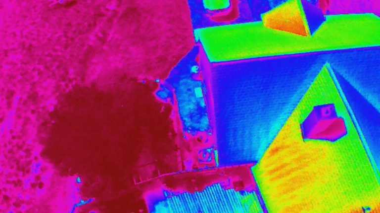
You’ll also find some imaging businesses flying drones that can see heat. Thermal imaging pinpoints cold spots on a building’s exterior, showing exactly where insulation is weak or if water is collecting behind walls.
Clear communication really matters too. Imagine showing everyone a 3D model of how things are coming along. This helps folks in meetings see the same picture, stopping arguments before they even start.
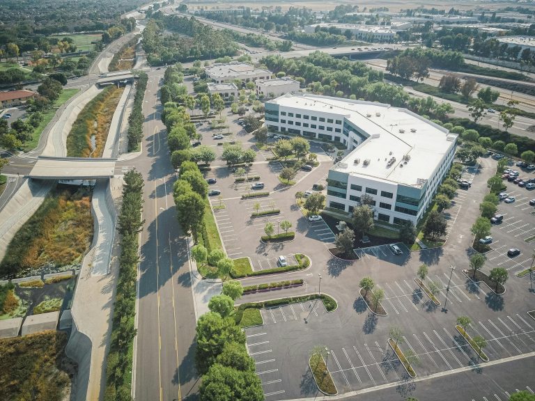
For Commercial Real Estate
In the competitive world of commercial real estate, a picture may be worth a thousand words, but a 3D model is invaluable. Aerial mapping helps developers and brokers market a property before it is even built. Create vivid 3D pictures and videos of the finished building. Potential residents or buyers will see it right in its actual spot.
During the planning phase for a commercial real project, aerial maps are used for detailed site analysis. Figure out what you can see clearly. You’ll also precisely map out property boundaries and design routes for new roads.
Architects use land elevation details to sketch buildings that really belong in the natural setting. This often helps them get construction permits faster from city halls in Massachusetts cities like Boston or Cambridge.
For Infrastructure and Utilities
Managing large areas of infrastructure like power lines, pipelines, or railways is a massive undertaking. Forget slow, risky inspections for these assets. Aerial mapping provides a quick, safe, and truly effective way to check on them. A licensed FAA certified pilot can fly a drone along a utility corridor to capture high-resolution images of every component, spotting damage or wear without sending a crew into remote or hard-to-reach areas.
LiDAR is particularly useful in this sector. This system can spot when trees or branches get too close to power lines. That’s a common reason why homes lose electricity. As noted by energy industry experts, proactive vegetation management is a top priority for utility companies.
The images from these photo jobs aren’t just pictures; they build a precise digital record of every single item you have. When you’ve got a detailed drawing showing every pole, transformer, and line, planning out future maintenance becomes much simpler. You can update this complete map of your facilities right after every inspection flight. That makes your work more effective and keeps everyone safer.
Conclusion
Projects throughout New England move quickly, and you cannot afford to work with slow, outdated, or incomplete information. Getting professional aerial mapping drone services really gives you a boost. With solid facts you can act on, you’ll see lower expenses, quicker project finishes, and a safer workplace.
Making smarter choices from your project’s start to its finish really changes things. Whether you’re in construction, real estate, or utilities, getting a clear view from above is no longer a luxury. Modern and professional aerial mapping services in Boston are now an essential tool for success in a competitive market.