Aerial Real Estate Photography Services in NH
Are your New Hampshire homes simply blending in with all the others? Do you feel that they don’t truly convey the property’s impressive size?
Many sellers and developers feel this same frustration.
You need a solid way to make potential buyers pause their scrolling.
Stunning drone photos for New Hampshire homes truly help you stand out.
This way, you present a property’s complete character, not just a handful of its rooms.
Using stunning drone pictures for your New Hampshire real estate does more than just impress; it’s a smart move that helps properties sell more quickly and for a higher value.
What Exactly Is Aerial Real Estate Photography?
You might think it’s just someone flying a drone and snapping a few pictures. It’s actually much more than that.
This is a professional craft that blends technology with artistic skill to create a compelling visual story.
Professional photography services utilize high-resolution cameras mounted on stable, advanced drones.
These machines are state-of-the-art equipment, featuring GPS and sophisticated gimbals, which enable them to capture smooth drone video and incredibly sharp real estate photos at angles that wouldn’t be achievable from the ground.
Why Your New Hampshire Property Needs Drone Photos
Think about the last time you looked at listings online.
Did any of them truly grab you?
Standard, eye-level property photography often fails to tell the whole story.
They can’t show the layout of the land or how a house sits in relation to its neighbors.
Drone photography fixes this problem and creates a powerful first impression.
It helps provide professional visuals that drive interest.
Capturing the Full Picture
A property isn’t just four walls and a roof.
It’s the sprawling backyard, the long driveway, and the beautiful trees surrounding it.
Aerial photos capture all of this in a single, compelling shot, making it ideal for both residential and commercial real estate.
This context helps a potential buyer visualize their life there.
They see the space for their kids to play or the privacy the wooded lot gives.
It turns an ordinary listing into an extraordinary one.
Creating an Emotional Connection
People make decisions based on emotion.
A sweeping, cinematic drone video of a home at sunset does more than show information.
Capturing stunning aerial views creates a feeling of awe and desire.
You’re not just selling a building; you’re selling a dream.
Aerial shots make a property feel grander and more important.
They turn a simple house into a majestic estate by offering an amazing and distinct view.
Standing Out From the Crowd

The New Hampshire real estate market is competitive.
Your listing is up against dozens, maybe hundreds, of others.
How do you make yours the one people remember and improve website traffic to your listing?
Drone photos are immediate attention grabbers.
They break the pattern of boring, repetitive ground-level shots.
A stunning aerial image is the best way to stop the scroll.
This gives you a huge advantage as one of the top real estate agents.
It shows you’re a serious seller who has invested in presenting the property in the best possible light.
Finding the Right Aerial Real Estate Photography Services Provider in NH
So, you’re convinced you need drone photos.
Now what?
Choosing the right professional to work with is an important step.
You need a team that consistently delivers professional results.
Not all drone operators are created equal.
You need someone with the right credentials, experience, and equipment to handle your estate photography needs.
Here is what to look for when you need help.
Check for FAA Part 107 Certification
This is the most important factor.
Anyone flying a drone for commercial purposes must have an FAA Part 107 certification.
It is the law, and there are no exceptions for real estate photography.
A certified drone pilot understands airspace rules, weather limitations, and safety procedures.
Hiring an uncertified pilot puts you and your property at risk.
Always ask to see their license before you hire them for any drone services.
Look at Their Portfolio
You wouldn’t hire a painter without seeing their work, would you?
The same goes for a drone photographer.
A strong real estate photography portfolio is worth a thousand words.
Review their past projects closely.
Do you like their style, and does it align with your branding portfolio?
Pay attention to the lighting, composition, and sharpness in their photography portfolio to gauge the quality of their work.
Their estate photography portfolio should show a range of properties.
This demonstrates their ability to handle diverse types of projects and challenges, ranging from small rental properties to large commercial listings.
Understanding branding for various property types is a valuable skill.
Understand Their Equipment and Process

The quality of the drone and camera makes a big difference.
A professional will use state-of-the-art equipment capable of shooting high-resolution images and 4K drone video.
Ask about the type of equipment they use for their photography services.
Cheaper, consumer-grade drones often produce grainy or distorted images that can harm your listing more than help it.
A professional invests in their tools to deliver the best results.
This commitment to quality should be evident in their work.
This also includes their editing process.
Great post-production work is what turns a good photo into spectacular, stunning real estate photography.
It involves color correction, sharpening, and other adjustments to make the property look its absolute best.
Ask About Insurance and Turnaround Times
Accidents are rare, but they can happen.
A professional drone operator will carry liability insurance.
This protects you and your property in the event that anything goes wrong during the photoshoot.
Ask for proof of insurance.
If a pilot doesn’t have it, that is a major red flag.
This indicates that they are not operating a serious, professional business.
You should also inquire about their standard turnaround times.
In the fast-paced real estate market, getting your photos quickly is crucial.
A company offering fast turnaround can help you get your listing live sooner.
Preparing Your Property for an Aerial Photoshoot
To get the most out of your investment, it helps to prepare the property before the drone pilot arrives.
A little bit of prep work can make a huge difference in the final real estate photos.
This preparation helps the photographer capture images that truly shine.
First, focus on the exterior of the property.
Clean the windows, remove any debris from the roof, and power wash siding or patios if they look dirty.
These small details are highly visible from the air.
Next, tidy up the landscaping.
Mow the lawn, trim overgrown bushes, and clear away any fallen leaves or branches.
Hide garbage cans, gardening tools, and children’s toys to present a clean, uncluttered look.
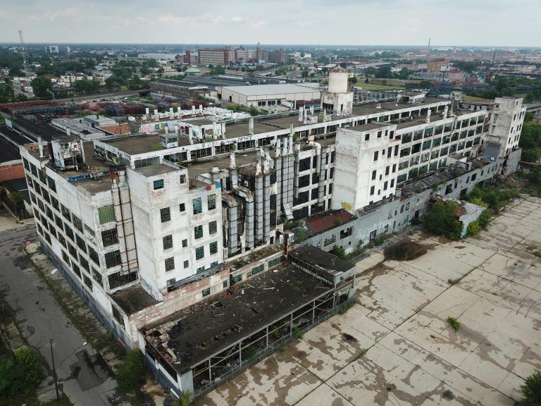
Beyond Residential: Drones for Commercial & Construction
Drone photography isn’t just for beautiful houses.
It’s a powerful tool for commercial real estate, construction, and utility sectors.
These projects are often large and complex in nature.
Aerial imagery makes it easy to understand the full scope of the site.
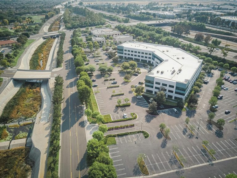
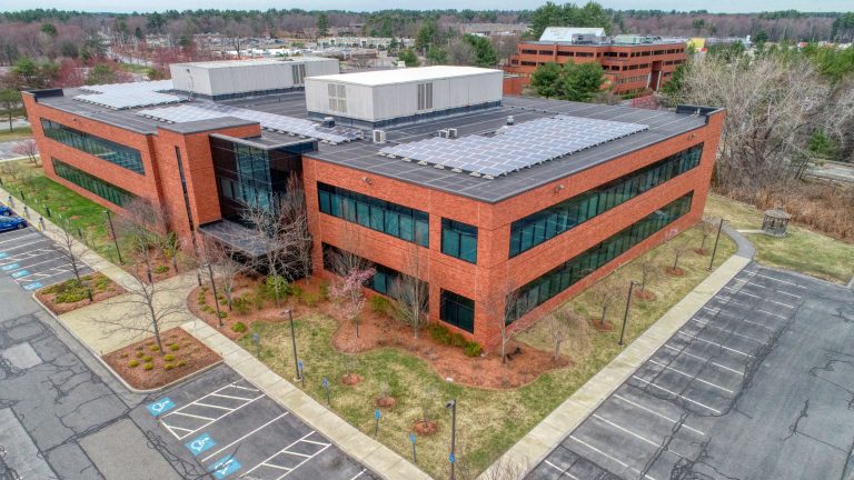
Commercial Real Estate Power Plays
How do you market a huge office park or a sprawling retail center?
Ground-level photos are completely inadequate for commercial photography.
You need to show the scale of the investment with clear aerial views.
Aerial shots can showcase the entire complex.
They can highlight ample parking, high-traffic locations, and proximity to major highways.
They are also helpful for creating supplemental marketing materials, such as digital renderings.
This helps potential tenants or buyers understand the strategic value of the location.
These visuals can also be combined with virtual tours for an immersive website experience.
Tracking Construction Progress from the Sky

For construction managers, keeping stakeholders informed is a big challenge.
Regular site visits can be time-consuming and inefficient.
Drones offer a much better solution for project oversight.
Regular aerial surveys provide a clear, top-down view of progress.
This visual data aids in project management, drone inspections, and informed decision-making.
Investors and clients can see the project coming to life without visiting the site.
As detailed by publications like Construction Executive, drones are also used for site mapping and roof inspections.
They make the entire process more efficient and data-driven.
Some services can even generate 3D models and basic floor plans from the imagery.
Essential for Utilities and Infrastructure
Imagine inspecting miles of power lines or the top of a giant wind turbine.
These are difficult and dangerous jobs for humans. But they are simple for a drone.
Drones provide a safe way to inspect critical infrastructure.
They can get close-up images of cell towers, bridges, and pipelines.
This helps companies identify potential problems before they become serious, saving time and money.
What Can You Expect to Pay?
Cost is always a factor in any business decision.
You are likely wondering what kind of investment is needed for professional drone photography services.
The photography pricing can vary significantly based on your specific needs.
It depends on several factors, including the size and complexity of your project.
The final real estate photography pricing reflects the time and skill needed to get great results.
Here’s a general idea of what you might see.
Remember to request a free quote for your specific project, as prices may not include travel expenses.
Some companies may even offer a premier program or an alpha premier program for repeat clients, like real estate agents.
| Service Package | Common Inclusions | Estimated Price Range |
| Basic Photo Package | 10-15 high-resolution aerial photos. | $250 – $450 |
| Premium Photo & Video | 20-25 photos + 1-2 minute edited video. | $500 – $900 |
| Commercial & Construction | Custom photo/video, progress tracking, mapping. | $750+ (project-based) |
Think of this as an investment, not an expense. The return you get from a faster sale or a winning project bid far outweighs the initial cost.
Legal, Privacy, and Licensing Considerations
When you hire a photography service, it is important to understand the legal framework.
A professional operator will be well-versed in local and federal regulations.
They will also respect the privacy of neighboring properties.
A reputable company should have a clear privacy policy outlining how it handles captured images and any related user data.
You can often find a link to the privacy policy on their website.
This protects both you and the service provider.
Finally, clarify image licensing and rights to avoid any confusion later.
Conclusion
In today’s visual world, standard photos are no longer enough to make a statement.
You need something more to capture attention and create a compelling visual story.
Drones give you that powerful new perspective, quite literally.
From showing off a beautiful NH real property to tracking a massive construction project, aerial imagery changes how people see your property.
It’s no longer a luxury for high-end listings. It’s an essential tool for any real estate agent, seller, or developer seeking success.
Your property has a story to tell, and the view from above tells it best.
Choosing the right partner for aerial real estate photography services in NH is the first step toward showcasing what makes your property special and achieving a faster, more profitable sale.