Thermal Imaging Drone Inspection Maine: Boost ROI
Running a business in Maine means dealing with some pretty harsh weather. From heavy snow and ice storms to damp, foggy seasons, your buildings and infrastructure take a constant beating.
You can stay ahead of maintenance issues that could cost you a fortune. Since many problems start small and are hidden from sight, a thermal imaging drone inspection offers a powerful solution.
You can now see what the naked eye simply cannot. This advanced drone technology helps you pinpoint problems with energy loss, moisture intrusion, and equipment failure before they become catastrophic.
Think of it as giving your property a health checkup from the sky, a departure from traditional methods that are often slow and expensive.
We’re going to explore what goes into a thermal imaging drone inspection in Maine and why it’s becoming an essential tool for businesses like yours.
Table of Contents:
- What Exactly Is Thermal Imaging With Drones?
- Why Your Maine Business Needs This Technology
- The Process of a Thermal Imaging Drone Inspection in Maine
- Finding a Qualified Drone Service Provider
- Real World Examples in the Pine Tree State
- Conclusion
What Exactly Is Thermal Imaging With Drones?
You have likely seen those colorful images where hot objects appear red and cold objects look blue. That is thermal imaging in a nutshell. It is not a photograph but a visual representation of temperature variations across a surface.
Every object gives off thermal energy, also known as a heat signature. Special cameras, called radiometric thermal imagers, detect this energy and translate it into a visual map. When you mount one of these advanced cameras on a drone, you can get a temperature map of large areas quickly and safely from an aerial perspective.
The aerial data collected by the drone’s camera can reveal tiny temperature differences that are invisible to the human eye.
These patterns can point to serious underlying issues like failing insulation, hidden water leaks from a damaged roof, or electrical components that are about to fail, providing critical and actionable insights.
Why Your Maine Business Needs This Technology
You might be thinking, is this really necessary for my company? If you manage any kind of physical asset, from a commercial roof on a warehouse to a series of solar farms, the answer is very likely yes. Let’s look at how different industries can use this technology provided by drone services maine.
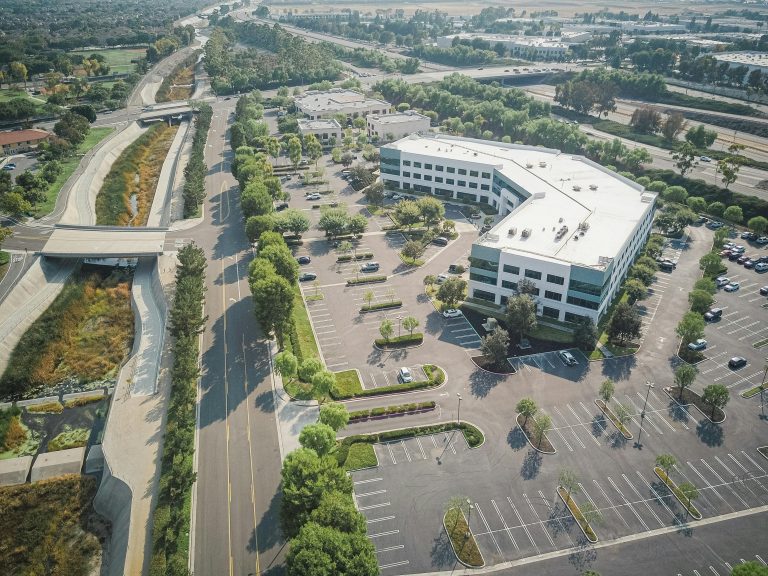
For Commercial Real Estate and Construction
Your building’s envelope is its first line of defense against the elements, and a thermal drone inspection can serve as a diagnostic tool for your property.
Heat loss is a huge expense for any business in a cold climate. Gaps in insulation or poorly sealed windows and doors let your expensive heated air escape.
A thermal drone can fly around your building and create a map showing exactly where the heat is leaking out, helping you target repairs effectively and improve energy efficiency.
Moisture is another major enemy, particularly for a commercial roof. A slow leak can go undetected for years, causing rot, mold, and serious structural damage.
Since wet materials hold temperature differently than dry ones, a thermal camera can often spot the signs of water intrusion long before you see a stain on the ceiling.
For Utilities and Infrastructure
Maine has thousands of miles of power lines, often in rugged and hard to reach places. Sending crews to manually inspect all that equipment is slow, expensive, and dangerous. Drones have completely changed this process for infrastructure inspections.
Electrical components heat up before they fail. A thermal camera can easily spot an overheating transformer, insulator, or connection on a utility pole from a safe distance.
This lets utility companies perform targeted maintenance and prevent power outages that affect thousands of people.
Bridges, dams, cell towers, and other critical infrastructure also benefit. Thermal imaging can detect delamination in concrete, where layers are separating, long before it becomes a visible or structural crisis.
Finding these issues early can prevent a much bigger failure down the road, making it a critical tool for public safety and asset management.
For Energy and Solar Farms

Maine’s solar energy sector is growing rapidly. But how do you know if all those thousands of panels in your solar farm are working correctly?
Walking through a massive solar field to inspect each solar panel individually would take ages and is highly impractical.
A thermal drone can fly over an entire solar farm in a fraction of the time. Defective cells, faulty wiring, or soiled panels show up as hot spots on the thermal drone imagery.
This is because malfunctioning parts of a solar panel are unable to convert sunlight into electricity and instead dissipate that energy as heat.
Identifying these underperforming panels allows you to fix or clean them, maximizing your energy output and your return on investment. It’s a much more efficient way to manage your assets and protect your bottom line.
The Process of a Thermal Imaging Drone Inspection in Maine
So what can you expect when you schedule consultation for a thermal inspection? It’s a detailed process that involves much more than just flying a drone around.
A professional drone service will follow a clear and safe workflow for every service project.
The Initial Consultation
First, you will talk with the drone service provider. This is where you explain your goals. Are you worried about a specific roof? Or do you need a general health check of your entire property portfolio?
This conversation is important because it defines the scope of the project and helps the team provide drone solutions tailored to your needs.
The team will ask questions to understand what kind of issues you want to find. This helps them plan the mission and know exactly what to look for during the data analysis phase.
Flight Planning and Safety
Safety is the top priority in any professional drone operation. The certified drone pilot will create a detailed flight plan that maps out the drone’s path using advanced aerial mapping software. They will also check the surrounding area for obstacles and potential hazards.
Before the drone even takes off, the team conducts extensive pre-flight checks. They look at weather conditions, especially wind, direct sunlight, and humidity, which can affect thermal readings.
A professional pilot operating a commercial aerial drone must be licensed by the Federal Aviation Administration under Part 107 rules.
Companies that prioritize safety will also carry comprehensive liability insurance. They understand how to operate safely around active job sites, public spaces, and critical infrastructure. This commitment to safety protects their team, your property, and the public.
The Inspection Flight
During the inspection, the FAA-certified drone pilot flies the planned route. They maintain a consistent altitude and speed to capture high quality data. Often, a second person, a certified thermographer, is controlling the camera and monitoring the thermal feed in real time.
The drone captures both thermal and high resolution visual aerial imagery. This allows for a direct comparison later. Seeing a hot spot on a thermal image is one thing; seeing what it corresponds to on a visual photo is what provides context and makes the data truly useful.
This comprehensive aerial data collection is what separates professional drone photography services from hobbyists. The combination of visual and thermal drone video and stills creates a complete record. This record can be used for reports, insurance claims, and maintenance planning.
Analysis and Reporting

This is where the real value comes in. Raw thermal images can be misleading without proper interpretation by an expert with active intelligence in the field. They will look for thermal anomalies, or patterns that are out of the ordinary.
They use specialized software to analyze the temperature data from every pixel of the image. It takes training and experience to know the difference between a real problem and a false positive caused by a reflection or other interference.
After the analysis, you will get a comprehensive report. This usually includes the thermal and visual images, with important areas highlighted and annotated. The report will explain what the findings mean and recommend next steps for you to take, turning raw data into actionable information.
Finding a Qualified Drone Service Provider
Not all drone pilots are qualified to perform technical thermal inspections. This is a specialized field that requires specific training and equipment. Here is what you should look for when searching for Maine drone services.
A reputable provider offers a wide array of services beyond just flying a drone. They are consultants who can help you understand the data and make informed decisions. When you choose Midcoast Aerial Imagery, for instance, you are working with a team that understands the local landscape and its challenges.
- Certification: The pilot must have an FAA Part 107 license for commercial flights. More importantly, the person interpreting the data should be a Certified Thermographer. Organizations like the Infraspection Institute offer professional training and certification programs that demonstrate a high level of competence.
- Experience: Ask for examples of their past work in your industry. Someone who specializes in inspecting building envelopes will have different skills than someone who inspects solar farms. Experience with roof inspections, especially commercial roof inspections, is vital for real estate and property management clients.
- Equipment: Ask about the drone and thermal camera they use. Drones equipped with higher resolution thermal sensors provide more detail and lead to more accurate findings. The quality of the equipment and the latest technology can make a huge difference in the results.
- Insurance: A professional service provider will be fully insured. Ask for proof of liability insurance before any work begins. This protects you and your property in the unlikely event of an accident.
Conclusion
For businesses across New England, protecting your assets from the weather and normal wear and tear is a constant battle.
Problems you cannot see are often the most damaging and expensive to fix. A proactive approach using a thermal imaging drone inspection in Maine is one of the smartest investments you can make.
This technology helps you find hidden issues, reduce energy costs, and prevent small problems from becoming expensive disasters.
It empowers you with clear, understandable data to make better maintenance decisions for everything from a single real estate property to large-scale infrastructure.