Drone Inspection Services for Bridges Maine: A Guide
Drone inspection services for bridges in Maine are fundamentally changing infrastructure maintenance.
Bridges in Maine take a beating from icy winters and the constant bite of sea salt.
With these sophisticated aerial vehicles, assessing the structural integrity of our bridges becomes a considerably safer, more expedited, and financially prudent operation.
The days of risky, rope access, manual climbs, and traffic-halting inspections are becoming a thing of the past.
Benefits of Using Drones for Bridge Inspections in Maine
Here are the main benefits of using Maine drone services for bridge inspections.
Improved Safety
Safety is a primary advantage of using drones for bridge inspections. Inspectors won’t have to dangle from ropes or handle heavy equipment in dangerous, unstable spots.
By keeping personnel on the ground for the visual inspection, the risk of falls and other workplace accidents is drastically reduced.
Critically, it also strengthens the overall safety of the community. With fewer lane closures and on-site disruptions, the potential for traffic accidents related to the inspection work is minimized.
Significant Cost Savings
Traditional bridge inspections often involve expensive equipment rentals, traffic control setups, and extensive labor hours.
Drone bridge inspections reduce or eliminate many of these costs. Without the need for lane closures, the indirect economic impact on local commuters and businesses is also greatly diminished.
Imagine inspecting things more often, but your budget stays exactly the same – a good drone makes that happen.
Spotting little issues early prevents them from growing into massive structural headaches. This keeps Maine from shelling out big money for repair bills down the road.
Faster Inspection Turnaround
A drone can survey a standard bridge in a matter of hours, a task that could take a manual team several days to complete.
This speed allows transportation departments to assess more of their assets in a shorter period. After a major storm, such as a severe flood or heavy ice, this lets us get a fast look at the damage.
You’ll see this same smooth operation when your data gets sent out, too.
Digital drone photos and video can be processed and delivered to engineers almost immediately, providing them with the information needed to make swift and actionable decisions.
Keeping things like bridges and power lines safe really depends on getting important facts quickly.
Better Data

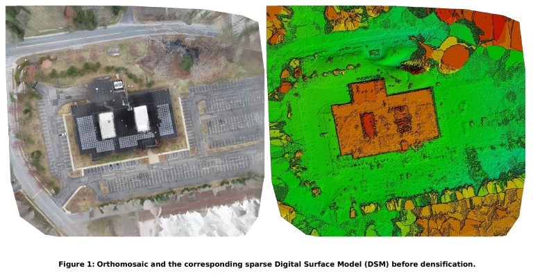
Unmanned aerial vehicles effectively collect extensive empirical data.
High-definition cameras take super clear pictures, helping engineers easily find tiny hairline cracks, flaking concrete, or rust spots that a human eye would totally miss.
The crisp views from overhead pictures make your inspection reports much more dependable.
This technology also creates a permanent digital “twin” of the bridge.
These detail-rich aerial photos can be archived and compared against future inspections to track the rate of deterioration over time.
You can predict future repair jobs and use your money more effectively by reviewing old records.
How Drone Inspections Work for Maine’s Bridges
When a bridge in Maine requires an inspection, the process involving drones is methodical and efficient. Here is a typical breakdown of the steps involved:
- Planning: The inspectors first look over the bridge’s original drawings and all previous check-up records. You’ll see them planning the exact flight route. That way, they hit every important part of the structure and know just what data to grab.
- Setup: On-site, the certified drone pilots conduct pre-flight checks on the equipment. You need to set up the drones and their detection gear precisely. The ground control station is established in a safe location with a clear line of sight to the operational area.
- Flight: The drone is launched and follows the pre-programmed flight path, which can be adjusted manually by the pilot as needed. They stay a good distance back, grabbing excellent pictures of the road, its supports, and the big frame.
- Data Collection: As the drone zips along, its cameras and sensors gather all the relevant data. They gather crystal-clear drone photos, stunning 4K drone footage, and sometimes even thermal images. Getting all the right aerial views is our mission, making sure no important angle gets missed.
- Analysis: After the flight, the collected data is uploaded for processing. After the drones finish their flights, a skilled team carefully examines all the captured pictures and video. They use smart computer tools to spot and record any problems, turning piles of raw information into clear steps for action.
- Reporting: All the details from our visual check go into a comprehensive report we then share. You’ll see pictures with notes right in the report. It also pinpoints where each problem is and suggests what to do next, such as investigating or repairing.
Types of Bridges that Benefit from Drone Inspections in Maine
Maine’s diverse landscape is home to many different types of bridges, each with its own set of inspection challenges. Drone technology is versatile enough to provide value for nearly all of them.
Coastal Bridges
The state’s extensive coastline features numerous bridges exposed to harsh marine environments.
Ocean spray quickly rusts steel and breaks down concrete.
Drones can easily perform close-up inspections in these areas, which are often difficult to reach, without requiring complex and expensive rigging.
River Crossings

Many of Maine’s most vital bridges span wide rivers like the Kennebec or Penobscot. Inspecting the underside of these structures is traditionally a complex operation.
Drones can fly underneath the bridge deck with ease, providing clear views of bearings and support structures that are challenging to assess from a boat or snooper truck.
Rural and Remote Bridges
In the more rural parts of Maine, bridges may be located in areas with difficult terrain, making access with heavy equipment problematic.
Drones are highly portable and can be deployed from almost anywhere.
This makes it easier for the Maine Department of Transportation to maintain a regular inspection schedule for these essential but out-of-the-way crossings.
Historic Bridges
Maine is home to several historic covered and stone arch bridges that require careful preservation.
Drones help us inspect things gently, gathering information on their current state without physical disturbance.
Checking these fragile structures without touching them protects their original state and keeps them perfectly safe to use.
The Future of Drone Inspection Services for Bridges Maine
Drone inspection gear just keeps getting better. That means we’ll see even bigger payoffs from it down the road.
AI: Acting on fresh data.

Artificial intelligence and machine learning are here. They’ll totally change how we analyze aerial imagery.
Imagine systems in the future that practically think for themselves.
They’ll spot and sort out flaws in pictures taken from the sky, getting it right almost every time.
Getting things checked will happen at a much quicker pace. This also removes a major source of little slip-ups or oversight from people.
Improved Battery Technology
Longer-lasting batteries will increase the flight time of unmanned aerial systems.
This will allow a single drone pilot to inspect larger, more complex bridges in a single deployment. Inspectors will get through many small bridges much faster in one day.
More Robust
New drones are getting built. These tough machines will soon fly even in nasty weather. Gusty winds or light rain often halt inspections.
Now, such weather won’t cause interruptions, providing a consistent year-round inspection cadence despite Maine’s dynamic climate.
Having more time to work helps us hit those important regulatory due dates.
3D Modeling and Digital Twins
Drone data is already being used to create detailed 3D models of bridges. Soon, these models will hit a new level of accuracy.
They’ll practically clone buildings in the digital space. With these models, engineers can test out repairs before they happen.
They also pinpoint where stress builds up and watch the bridge change over time.
Conclusion
Drones now checking Maine’s bridges truly improve how we care for public structures.
You’ll find these tools bring together top-notch safety, quick work, and spot-on information in a way old systems just can’t.
With more aerial tech in the skies and more regulatory adoption, residents and visitors can count on state bridges getting regular, advanced check-ups.
The use of drone services ensures that maintenance is proactive, problems are caught early, and public funds are used effectively.